Geographical position: Central African country situated at the bottom of the Gulf of Guinea, between the 2nd and 13th degrees of north latitude and the 9th and 16th degrees of east longitude.
Area : 475 442 km²
Population: approximately 20 000 000 inhabitants
Gross domestic product: 4.6%
Borders :
Main cities :
Yaoundé : political capital and seat of the Institutions
Douala : economic capital, port city, commercial and industrial.
Other major urban centers :
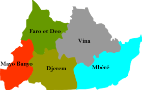
Click on a region of the map to view the information.